















The four towns of the highlands that the world knows, Buon Ma Thuot, Pleiku, Kon Tum and Da Lat, all carry highland names, and all grew up on highland land as posts of someone else’s government: a Rhade chief’s village made a French residence, a Jarai village made a militia post, a Bahnar village made a mission and then a province, and a pine-covered plateau of Lat villages made a sanatorium for Europeans. Every promise the state has made to us was made in one of them, and most of the things done to us were decided in one of them. This page gives each town its name, its origin, the people whose land it stands on, and what happened there, from the first French description to the last census we can trust.

Buon Ma Thuot
Name. Rhade: buôn is village, and the town is named for a village headman, Ama Thuot, “the father of Thuot,” in the Rhade way of calling a man by his child. The American Army’s handbook of 1966, which asked, recorded the tradition that “the father of Thuot was a very wealthy man who owned seven elephants and had conquered that entire area.” The French, coming from the Lao side, wrote the Lao word for village and made it Ban Mé Thuot, which is what the French and American files say for seventy years; the Vietnamese made it Buôn Ma Thuột. The town has three names and all of them mean the same village.
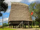
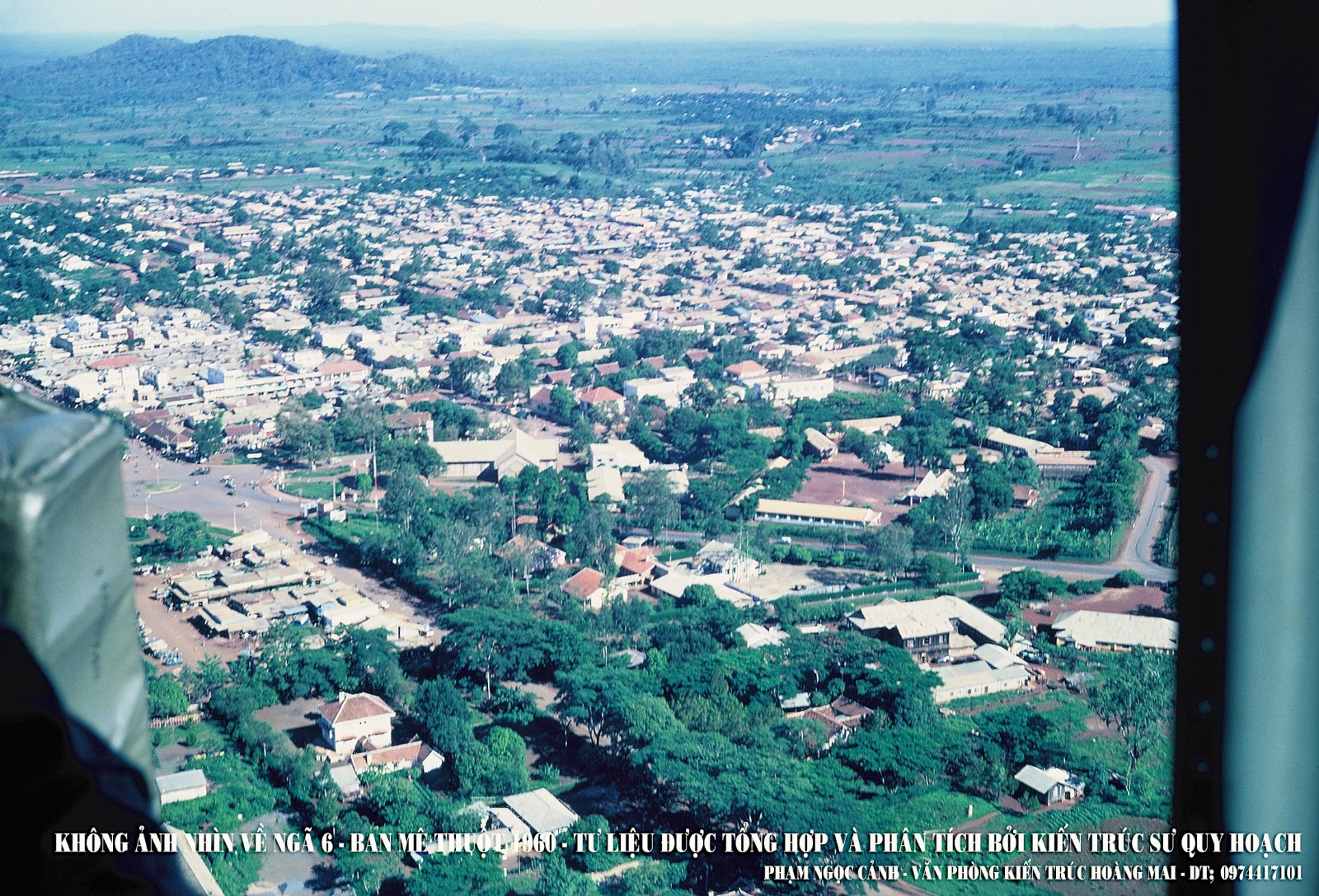
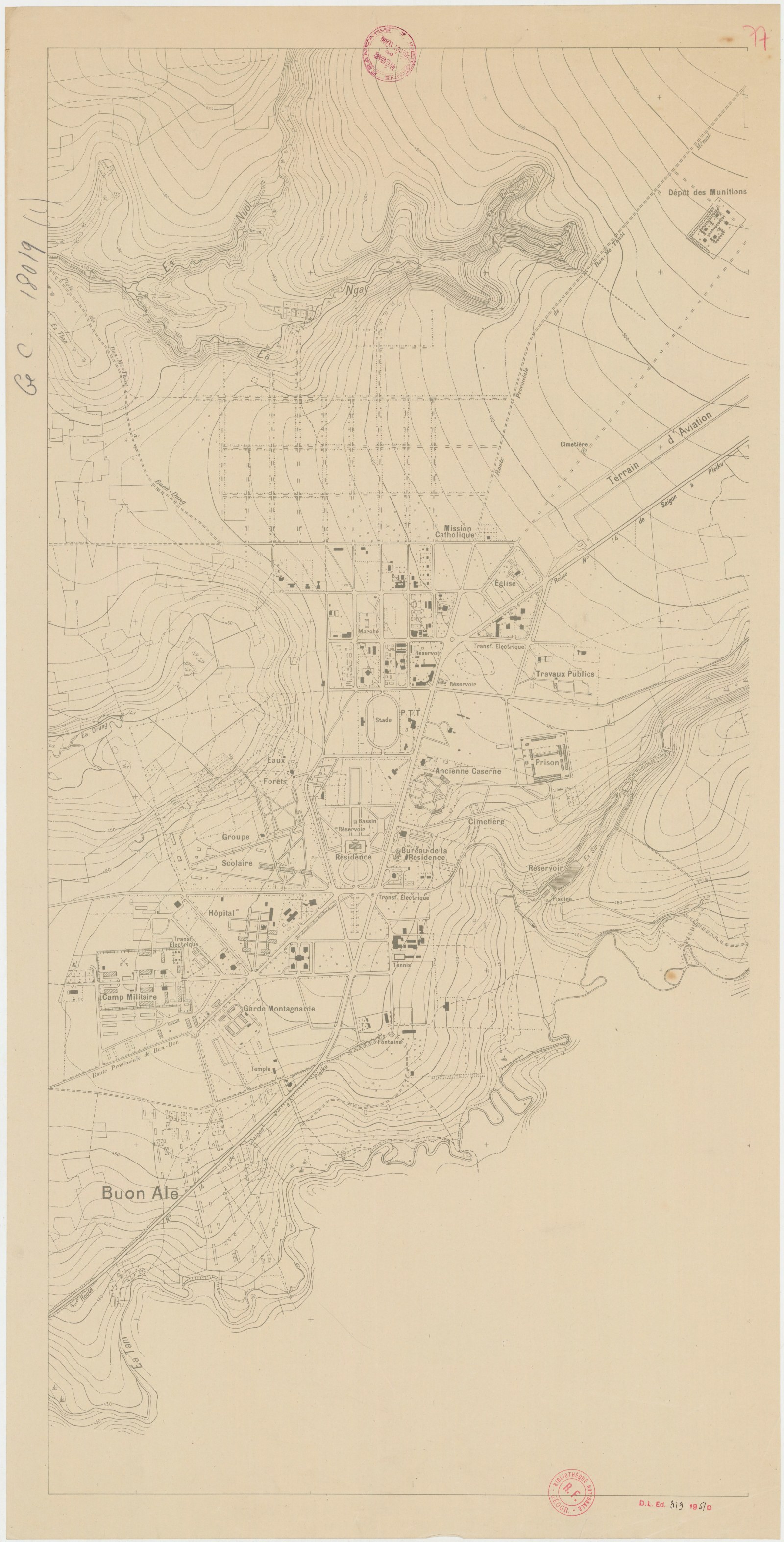
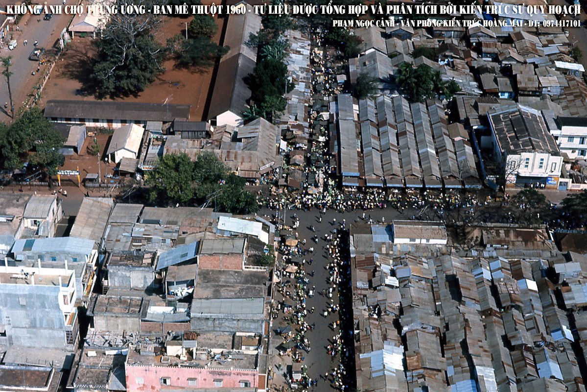
Origin. The first French post in the Darlac was not here but at Ban Don on the Srepok, beside the Khunjunob, in 1899; the commissioner Bourgeois died at his work in 1901, and his successors, Bardin and Besnard, moved to Ban Me Thuot, among the Rhade, when the Darlac was attached to Annam in 1904. Henri Maître, passing in 1905, described it as a pretty little village, “an oasis in the middle of a desert of greenery,” whose wealth was its two hundred and fifty elephants, exported for the most part to Siam through Laos. Léopold Sabatier made it a town between 1914 and 1926: a grid of streets, the Résidence, the Franco-Rhade school that boarded five hundred children, a hospital with a corps of Rhade nurses, the customary court of 1923, piped water, street fountains and electric light. The deputy who attacked him in the Paris Chamber in March 1927 described what Sabatier had built, meaning it as an accusation, and it is the best short description we have of the town in its first years: “an artificial center where there are a dozen houses, a water supply, street fountains, electric light,” a cinema, a dance hall, an infirmary and schools; “one can define it in a word: it is an acclimatization center for the Moï.” Sabatier had expelled the Vietnamese and Lao traders; after he was removed in 1926 the town became, in Hickey’s words, “a market center with largely Chinese and Vietnamese merchants, which served as a window to the outside world,” the plantations came, and in the 1920s a battalion of four companies with a mule-borne machine-gun section made Ban Me Thuot its headquarters. The Darlac had been made a delegation of Kon Tum in 1913 and was made a residence again in 1923; the penitentiary that held the colony’s political prisoners was built here under French rule, and is a museum now. In 1943 the province had eighty thousand people, four thousand of them Vietnamese (see Sabatier and the Rhade code and The Franco-Rhade school).
.jpg)
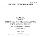
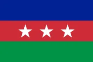
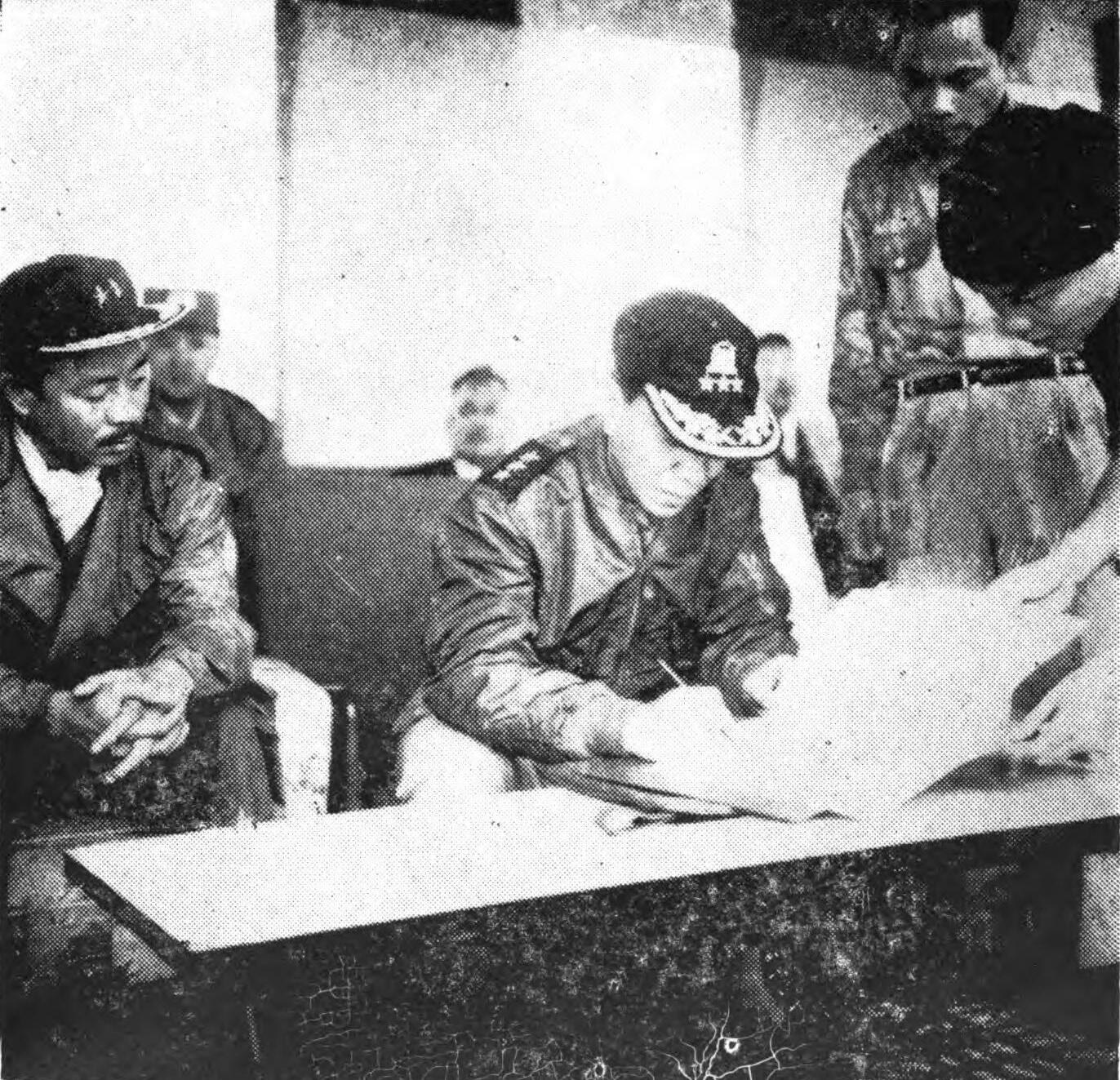
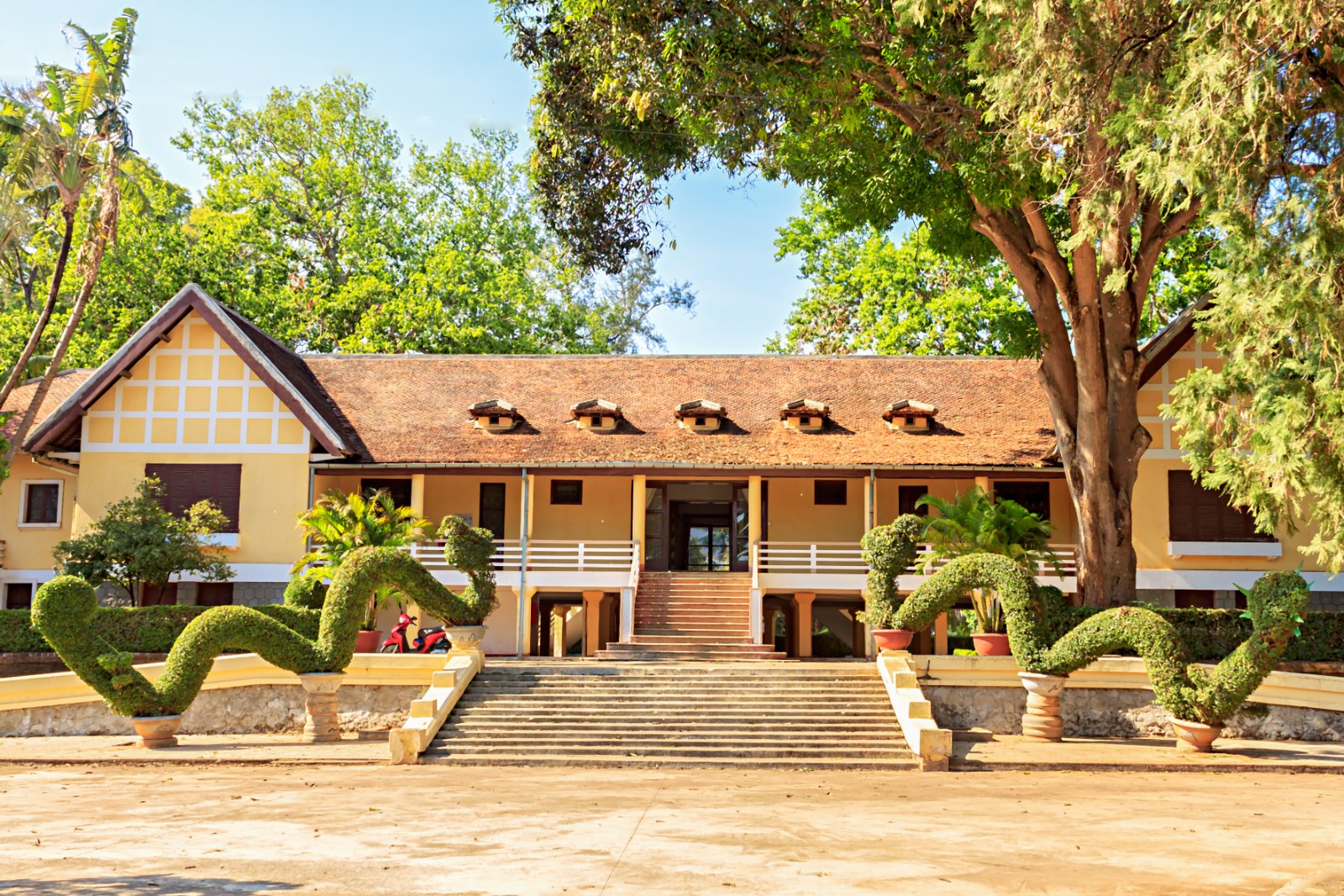
What happened here. On January 1, 1926, the Rhade chiefs swore their oath to France here, a ceremony the state has repeated for us ever since: in June 1955 the chiefs of the highland peoples were summoned to Ban Me Thuot and, “following a practice introduced by the French in 1926,” the American intelligence report says, took the oath of allegiance to President Diệm, and none of the promises Diệm made them that day was kept. In August 1945 Y Bih Aleo, a Rhade deputy chief of the Garde indigène, raised a militia here that drove the French out of the Darlac, and was sentenced to twenty years for it in 1946. From 1950 to 1955 the town was the seat of the Emperor’s delegate for the Crown Domain of the highlands, and hundreds of young men from every people met in the classrooms of the Collège Sabatier, learned Rhade as a common language, and made the friendships that became our politics; Bảo Đại’s lodge, built on the site of the French Résidence, still stands. In the 1950s a province chief forbade the Rhade to enter the town in their loincloths. On September 9, 1958, the Bajaraka leaders called a general strike in Ban Me Thuot, two thousand people demonstrated for five hours, and on September 15 the police arrested all seven of them; Y Bham Enuol was still in the town jail in 1963 (see The Bajaraka movement). On the night of September 19, 1964, some two thousand soldiers of the highland strike-force camps marched on the town, held the radio station and broadcast from it, surrounded the 23rd Division’s ammunition dump, and took Y Bham out of the town to their headquarters to the south; the FULRO was born here that week (see FULRO). On August 29, 1967, President Thiệu signed the Highlander Statute here with Paul Nur at his side. At Tet 1968 the North Vietnamese 33rd Regiment and a Viet Cong battalion fought four days in the town, destroyed the province headquarters and left a third of it in ruins; the American missionaries Henry Blood and Betty Olsen were taken from it and died on the trail (see Tet 1968 in the highlands). On the morning of March 10, 1975, rockets and artillery fell on the town, the 320th Division came in behind them, and by nightfall the center was theirs; the fall of Ban Me Thuot opened the offensive that ended the Republic of Vietnam in fifty-five days (see 1975). On February 3, 2001, three thousand people from Ea H’leo tried to enter the town and five hundred got in, and at three that afternoon three tanks were sent into the streets; in Easter week of 2004 thousands more tried, and people were beaten to death on the Phan Chu Trinh road outside the city and forty injured were counted in the provincial hospital in a night (see The protests of 2001 and Easter week 2004).

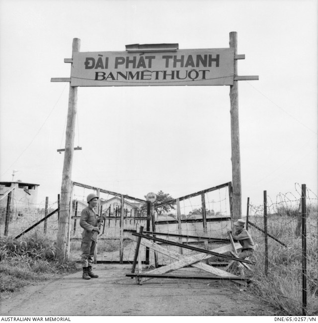

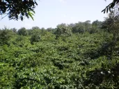
Now. The seat of Dak Lak, merged in 2025 with Phú Yên, and the center of the coffee trade; 326,000 people at the census of 2009, and more since. The Rhade and Mnong who were forty-eight percent of the province’s people in 1975 were twenty percent by 1997, and the province’s population, eighty thousand in 1943, was a million and a half by then. Reorganized into wards in July 2025. The Rhade villages of the edge, Ako Dhong and the rest, are wards of the city now, with their longhouses facing north (see Land taken for coffee and The great migration).


Pleiku
Name. Jarai: plơi is village, as in every Jarai place name; the second part is usually given as kơdưr, upper, so “the upper village,” and we print that as the usual explanation, not as a dictionary’s. The French wrote Plei-Kou and Pleikou; the Americans, whose war was run from here, Pleiku.
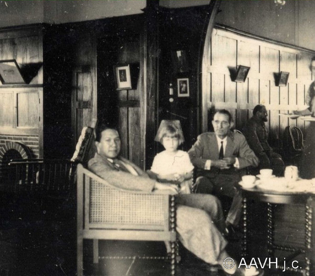
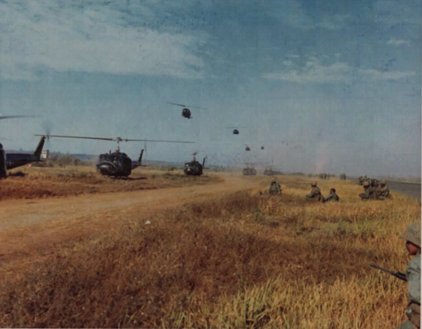
Origin. A Jarai village on the plateau between the Ba and the Se San, in the country of the Kings of Fire and Water, on the elephant road from Qui Nhon to the Kon Tum mission. In 1905, after Odend’hal’s death, the French made a province of Plei Ku Der under the administrator Plantié to watch the Jarai and the Kon Tum country, and put the mission inside it; the province was abolished in 1907 and the place became a militia post and then a delegation. In 1926 an agricultural station was opened here to see how rubber, kapok, coffee and cocoa behaved at altitude, the tea planters of the Catecka estate came, and the governor-general Varenne received all the planters of the Pleiku and Kon Tum region here on his tour of 1926 to promise them the country. The Emperor Bảo Đại was photographed on the plantation in 1933. By the end of the French war, in Bernard Fall’s description, it was “the fortified camp of Pleiku,” “the central anchor of the plateau,” with its “Far West atmosphere, where the few remaining French tea planters congregated every evening at the Embuscade Bar.”
.jpg)
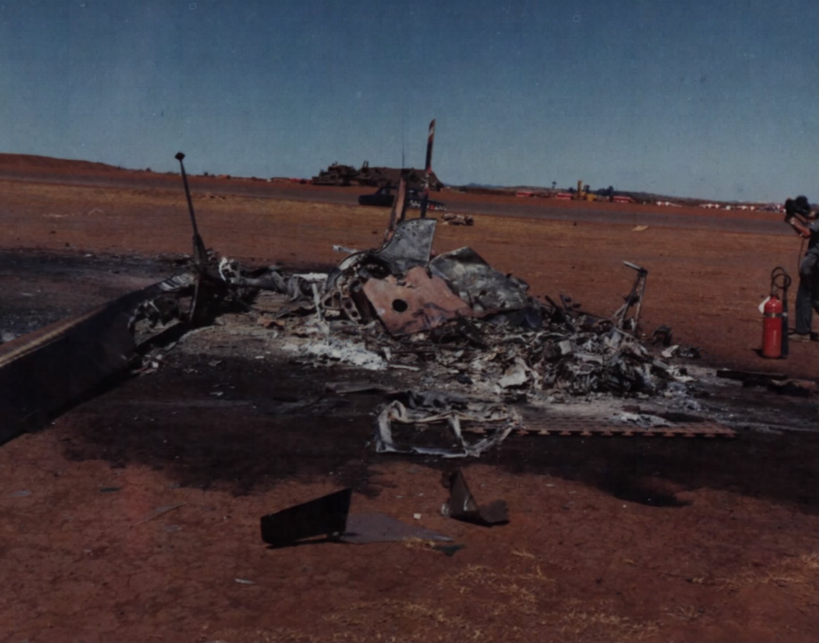
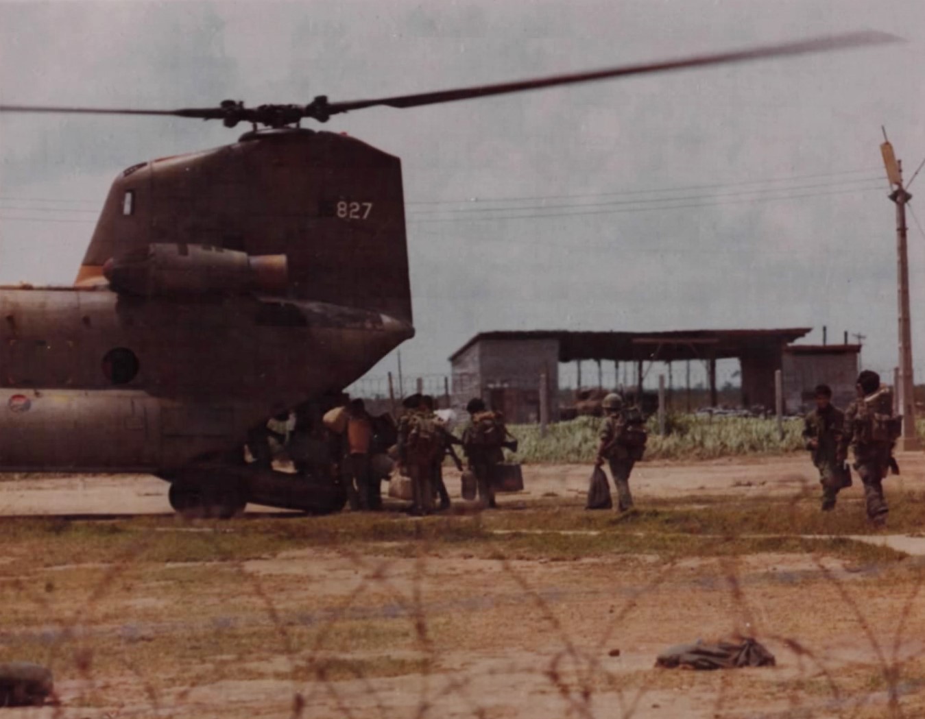
What happened here. On June 24, 1954, a month before the armistice, Groupe Mobile 100, ordered to give up An Khê and fall back on Pleiku across eighty kilometers of enemy road, was ambushed at kilometer 15 on Route 19 below the Mang Yang pass; Mobile Group 42, “recruited mostly from local mountaineers,” held the pass for it, and what reached Pleiku on June 29 was about half of what had left: of the 222 men of the headquarters company, 84; of three battalions of 834 men each, 452, 497 and 345. A second ambush at the Chu Dreh pass on the road to Ban Me Thuot on July 17 finished the group, and on July 27 Pleiku itself was shelled with the howitzers taken on June 24. In October 1964, after the September revolt, the government held a conference of highland leaders here at which the provinces presented their “aspirations.” At 1:50 in the morning of February 7, 1965, mortars fell on the American helicopter field and billet at Camp Holloway on the edge of the town; eight Americans were killed and more than a hundred wounded, the President’s adviser McGeorge Bundy was in the country, and the reprisal bombing of the North was ordered the same day; within a month the first American combat troops landed, and Pleiku became the headquarters of II Corps, of the American 4th Division and of the war in the highlands, with an air base, artillery on the hill above the town and camps all round it (see The American years and Battles on our land). At Tet 1968 two Viet Cong sapper battalions got into the town and were driven out by the end of the day. In May 1972 fourteen thousand refugees from the Kon Tum battle streamed into Pleiku. On March 14, 1975, President Thiệu decided at Cam Ranh to abandon the highlands, and General Phú left Pleiku with the order that Colonel Tất, promoted that afternoon, would take the corps and the two towns down Route 7B, the abandoned interprovincial road through Cheo Reo to Tuy Hòa. The first convoy left Pleiku on March 16. “People soon began to leave the city by every means of transportation available, even on foot,” the South Vietnamese chief of staff wrote afterward, “taking as little of their belongings as they could carry. They were later joined by refugees from Kontum, and together with the troops were going to form a long mass of humans and vehicles flowing along the hazardous Route 7B.” By the evening of March 18 the corps headquarters was at Cheo Reo and the whole column was stuck behind it, because no bridge had been built over the Ea Pa; the airstrip a mile from the command post was overrun; some highland regional and popular-force troops looted or broke and ran; a Ranger battalion was nearly wiped out; soldiers jumped into the river and drowned, and tanks sank in quicksand trying to bypass the road. The bridge was finished on March 22, the last block was broken on the 27th, and at nine that night the first vehicles reached Tuy Hòa: three hundred vehicles came in to refuel, five thousand people slept in a refugee center that night, and of five Ranger groups about nine hundred men reported to Nha Trang. “From a military point of view,” General Viên wrote, “the withdrawal was a complete failure.” How many of the tens of thousands of civilians on that road, highlanders among them, died or were lost has never been counted (see 1975 and Highland refugees of the war). On February 2, 2001, thousands of highlanders from dozens of villages marched into the town and filled the streets in front of the Party and People’s Committee offices; in April 2004 the police blocked the roads into Pleiku and the villagers of Gia Lai demonstrated in the district towns instead.

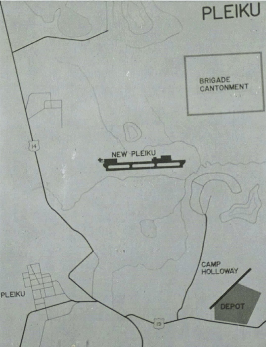

Now. 209,000 people at the census of 2009, the great majority Vietnamese; the last count that gave the town’s Jarai and Bahnar share came from a state planning document and we do not print it. On July 1, 2025, when Vietnam abolished its district-level cities and merged its provinces, Pleiku was reorganized into wards, and the enlarged Gia Lai, merged with Bình Định, is governed from Quy Nhơn on the coast. The lake in the old crater north of the town, Biển Hồ, is T’Nưng to the Jarai (see The Jarai).


Kon Tum
Name. Bahnar. Kon is village; Cupet’s footnote in 1891 says simply “kon. Village, in Bahnar.” Tum, in Dourisboure’s dictionary of 1889, the founder’s own, is “ponds near the great watercourses (they fill at the time of the floods)”: not a lake, for which Bahnar has another word, but the flood-ponds beside the Bla. Kon Tum is the village of the flood-ponds by the river, which is exactly where it stands.
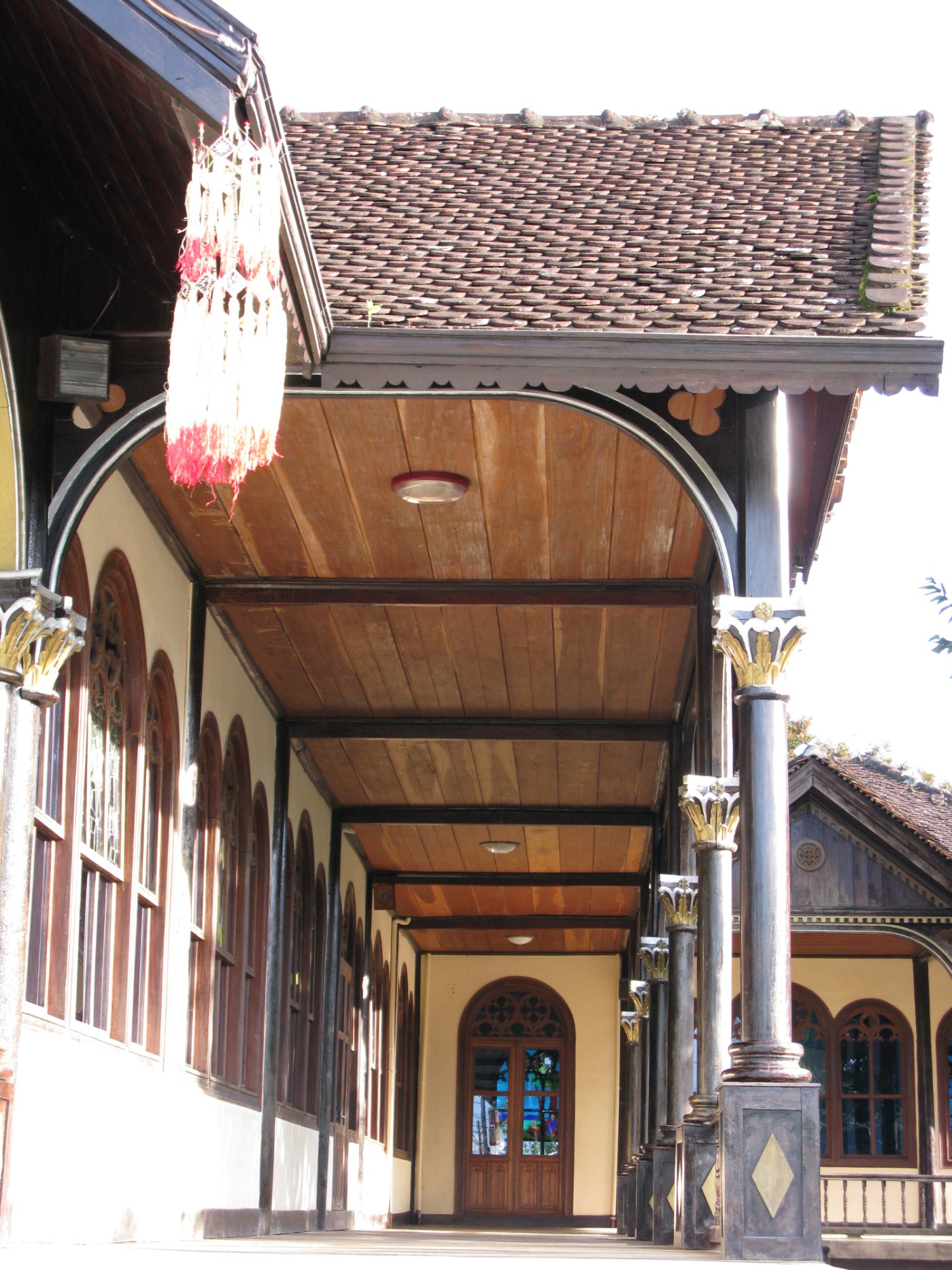
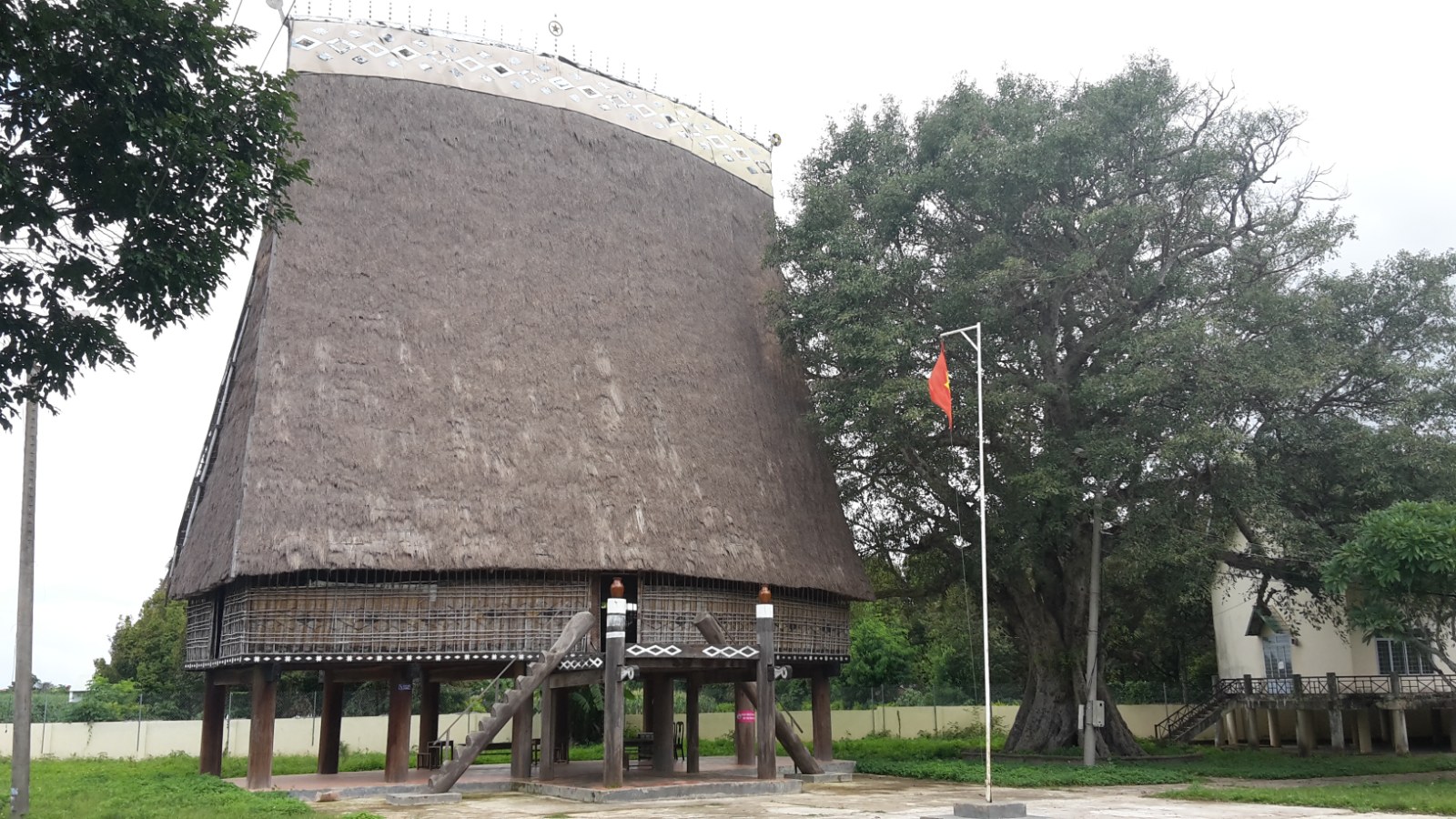
Origin. The oldest of the four as a place with outsiders in it. The Catholic mission settled among the Bahnar at Kơ Lang and Kon Kơxâm in 1850–51, and in 1856 the Vietnamese priest Nguyễn Do founded a new village east of his station at Rơhai and called it Kon Tum (see The first outsiders). Cupet reached it on February 21, 1891, coming down to the Bla, “a fine river, a hundred meters wide, shallow in this season, thirty or forty centimeters, with clear water watering a narrow plateau bounded on every side by a horizon of mountains,” and found the village of Kon Tum, residence of the mission superior Father Vialleton, close by. He described the mission as it then was: about forty years old, seven or eight villages strung over twenty kilometers between Plei Maria and Kon Trang, one for each missionary, an elephant road of five days’ walk to Qui Nhon, and, at the nucleus of the Christian community, “a colony of Catholic Annamites numbering from 400 to 500 individuals.” That is the first Vietnamese population of the future town, brought up by the mission as its founders had intended in 1842, and six hundred militiamen were sent up to Kon Tum by order of the governor-general the same year. The confederation of Bahnar, Rengao and Sedang villages that the mission had organized was dissolved in 1895 when the mission was attached to Lower Laos; a French delegation came in 1907 with a delegate “frankly hostile” to the fathers; in 1913 Kon Tum was chosen as the capital of a province that ran from the Sedang country to the Darlac. The wooden cathedral was begun in 1913 and dedicated at Epiphany 1918, built of the hardwood the Bahnar call ca chit with walls of mud and straw; the mission’s Cuénot school opened in 1905, Father Jannin had the Old Testament in Bahnar by 1909 and a big Bahnar book printed by 1925, and Rome made Kon Tum a vicariate on January 18, 1932, with Jannin as its first bishop; the seminary, the other great wooden building, went up between 1934 and 1938. In the early 1920s there were about two thousand five hundred Vietnamese at Kon Tum in six communes, most of them Catholics from Quảng Nam whom the mission had brought up (see The Kon Tum mission and The highland Catholic Church).

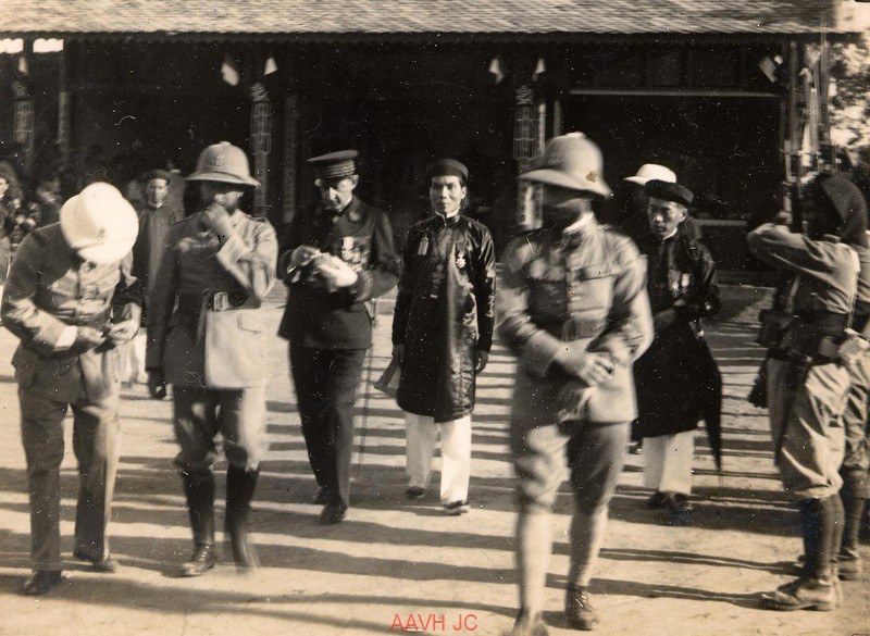

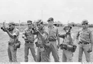
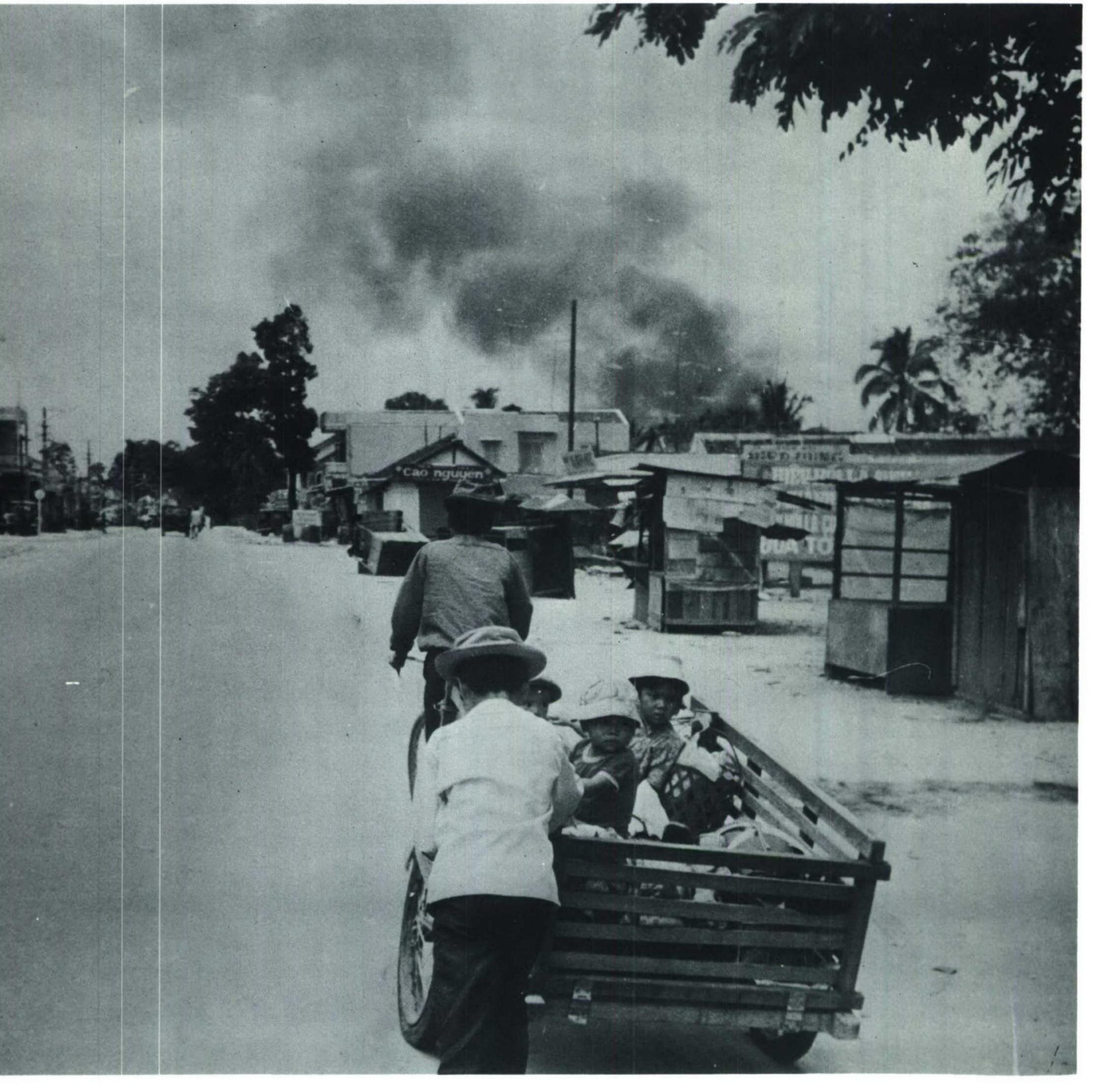
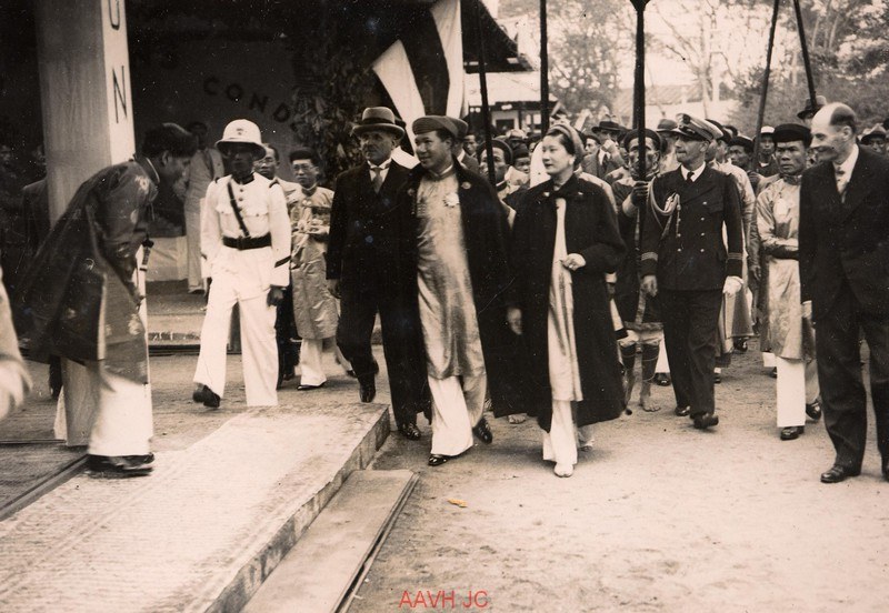
What happened here. In 1888 the adventurer Mayréna came through the mission on his way to be made king of the Sedang to the north (see The Kingdom of the Sedang). From 1932 the court at Huế had its own mandarin in the mission’s town, the quản đạo, and the town was shown to the court at the Huế fair of 1936 as coffee, tea and highland crafts. On March 15, 1945, the Japanese occupied Kon Tum and interned all the missionaries in the minor seminary; Bishop Sion came back by jeep on July 25, 1946, after six hundred kilometers of road, and found twelve seminarians left. At Tet 1968 the North Vietnamese 24th Regiment and a Viet Cong battalion fought four days in the town before they were driven out on February 3, with some six hundred and twenty-five of them dead by the American count. In the spring of 1972 the North Vietnamese came down from Dak To with tanks, and Kon Tum was the objective of the Easter offensive in the highlands: fifteen thousand refugees from the Dak To country were inside the town when the assaults on it began on May 14, eleven regular battalions and ten tanks held it, the B-52s struck four kilometers from the city, refugees were evacuated under fire, and when the enemy was cleared out on June 6 the South Vietnamese II Corps counted 382 of its own soldiers killed, 1,621 wounded and 32 missing (see Battles on our land). In March 1975 the army left Kon Tum with the Pleiku column and the town’s refugees went down Route 7B behind it. On February 14, 2001, three to four thousand people demonstrated in Kon Tum from three in the afternoon until eight at night.
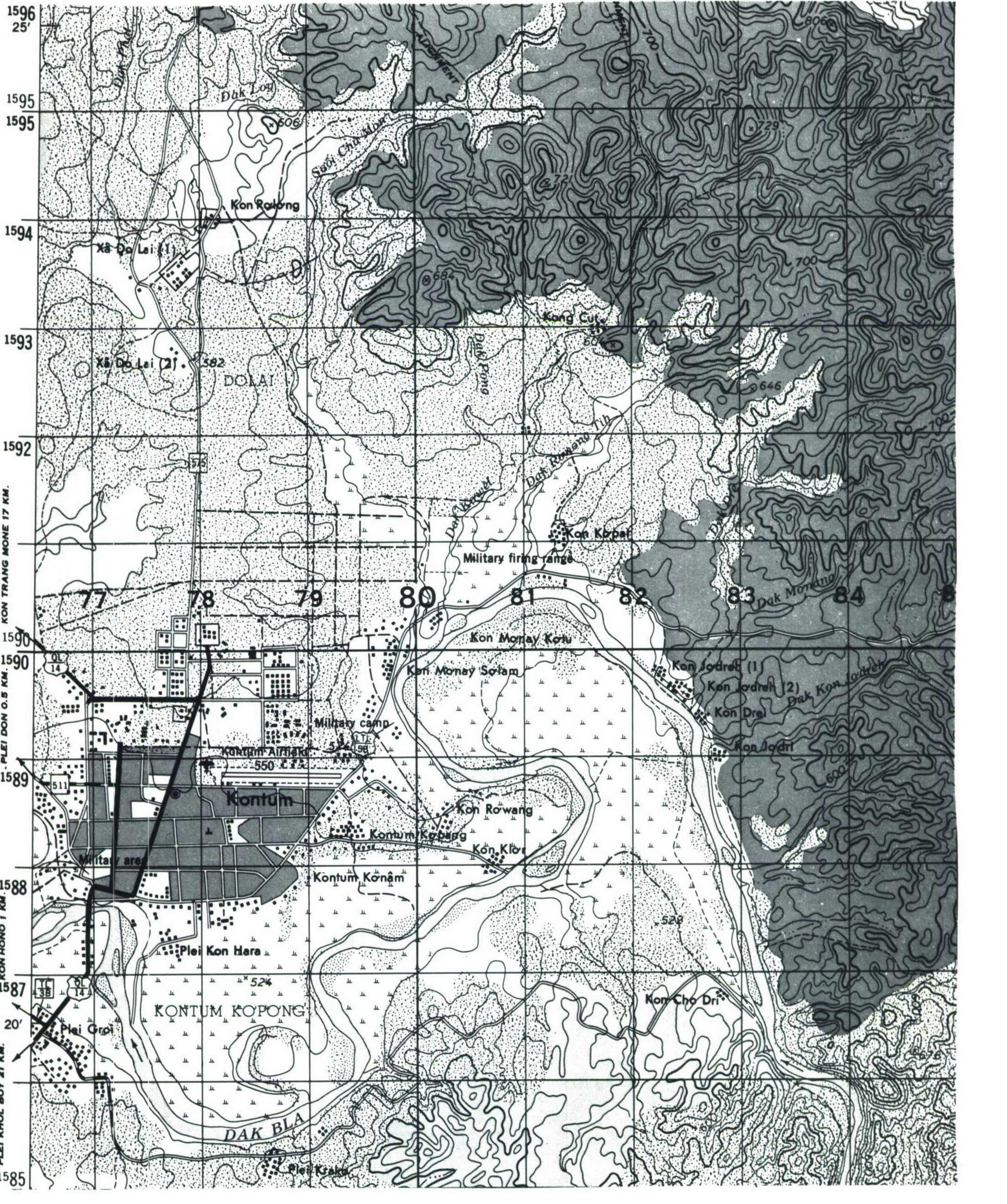

Now. 143,000 people at the census of 2009. Capital of Kon Tum province until July 2025, when the province was merged into Quảng Ngãi on the coast and the town reorganized into wards. The Bahnar villages of Kon Tum, Kon Rơbang and Kon Hara are wards of the city, with their rong beside the streets, and the mission’s two wooden buildings are what the tourists come to see (see The Bahnar).


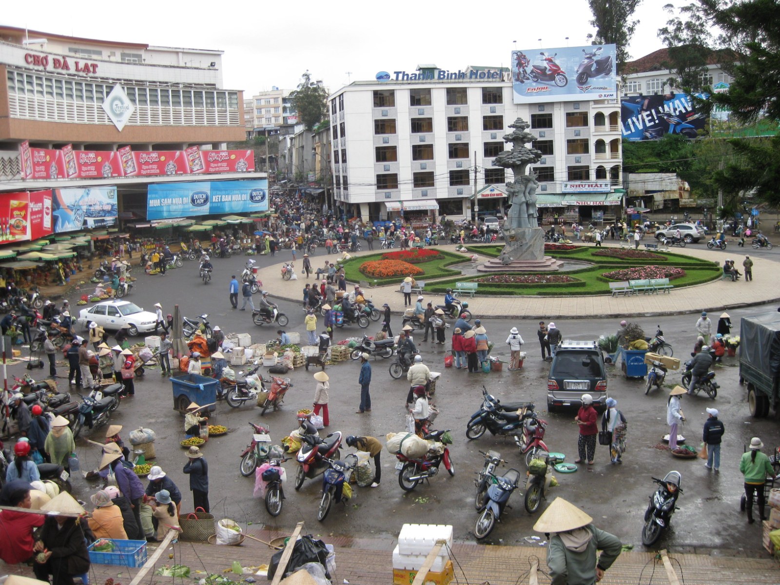
Da Lat
Name. Usually explained from the language of the Lat, a Koho people: đà or dà, water, stream, “of the Lat.” The French made a Latin motto of it for the town’s arms, Dat aliis laetitiam aliis temperiem, it gives some joy and others coolness, which tells you who the town was for. The mountain above it, Lang Biang, carries a Koho love story in its name. Paul Doumer, the governor-general who ordered the town built, wanted to call it Langsa, “the French town”; the Lat name is the one that stuck.
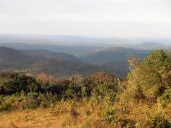
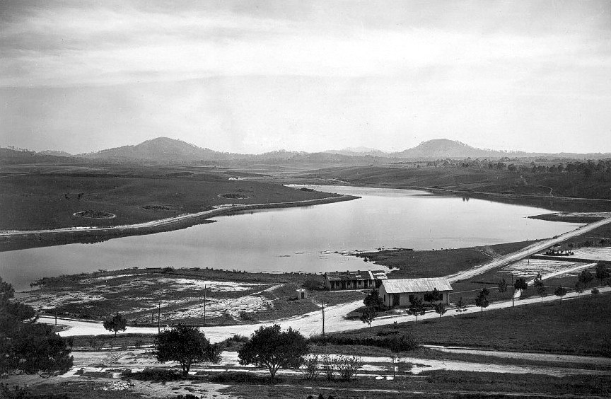
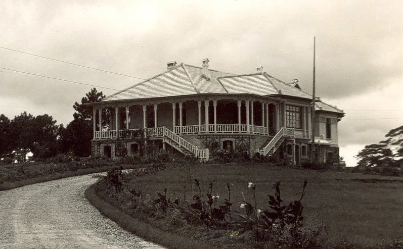
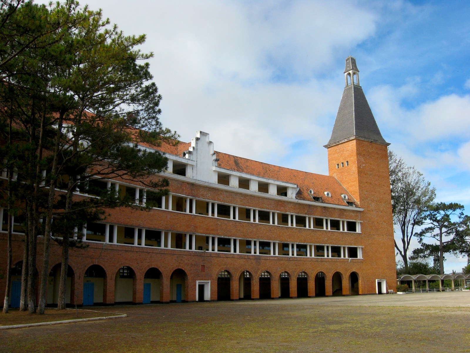
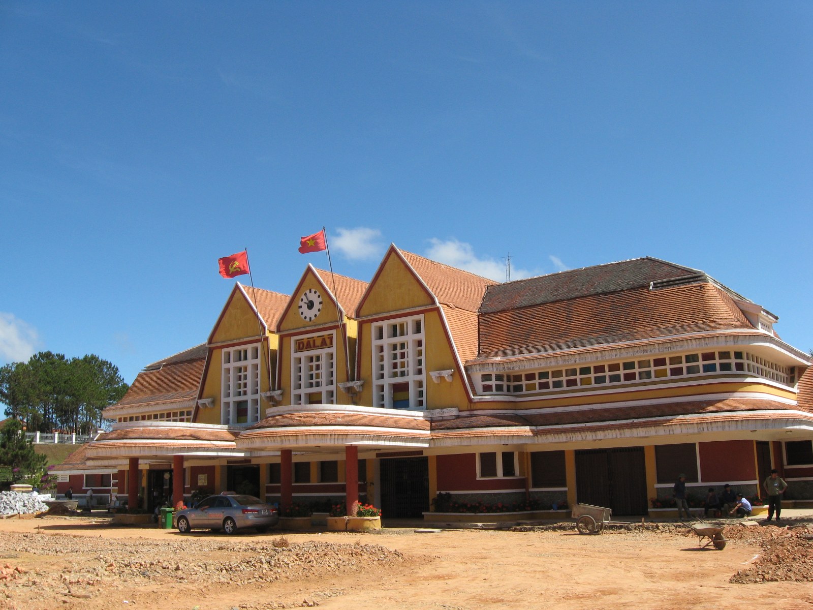
Origin. On June 21, 1893, the doctor Alexandre Yersin, coming up from the coast on the second of his three journeys, wrote in his journal of “a vast, barren plateau featuring rounded hills,” and remembered later his deep impression “when, coming out of the pine forest, I found myself facing this vast bare and deserted plateau, whose appearance recalled a sea churned by an enormous swell of green waves.” The Lang Bian was not deserted. Four Lat villages stood on it, Dankia, Peneur, Ankroët and Bendon, whose people, Yersin noted, no longer paid any tax to Annam and had no relations with the Vietnamese; Guérin calls them Maa. In July 1897 Doumer, fresh from reading about Darjeeling and Simla, ordered a search for the site of a mountain sanatorium, and Yersin told him at once of the Lang Bian. A meteorological station went up in 1898; when Doumer came unannounced in 1899 the European presence was some trial fields of vegetables near the Lat village of Dankia and two wooden houses at a place called Dalat at the top of the access path, on the edge of a pine forest; the nearest Frenchman was a forest guard who had built himself a house on a stream below. Odend’hal ran the sanatorium in 1901, three years before the Jarai killed him. A dozen chalets roofed in corrugated iron stood there in 1913; in 1916 an illustrated guide shows a village of one street; an ordinance of the Emperor of October 11, 1920, made the Lang Bian plateau an autonomous circumscription with the delegate of the Haut-Donnaï as its first mayor; the Langbian Palace hotel was completed in 1922, the lake made by damming the Lat stream, the governor’s summer residence and the villas built about 1925, the Lycée Yersin opened in September 1927, the rack railway from the coast reached the town in 1933 and its station was finished in 1938, and the cathedral was built in the 1930s. Under Admiral Decoux in the Second World War Dalat became a project of French prestige, the Plus-Grand Dalat, and doubled: at the end of his term, he wrote, it housed permanently six thousand Europeans and twenty-five thousand Vietnamese, and its villas had gone from four hundred to eight hundred. The Lat had been pushed off the plateau by then; in the Lang Bian region, where the highland peoples were still most of the rural population, they would bear the brunt of relocation again under the strategic hamlets of 1962 (see Koho, Maa, Churu, Raglai).

.jpg)
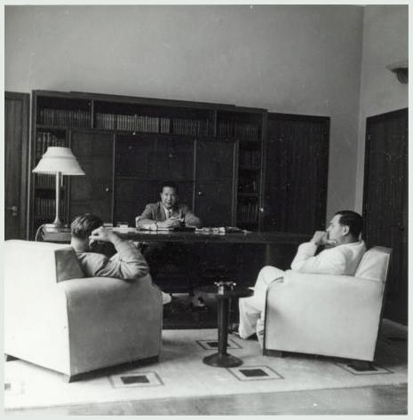
What happened here. It was the summer capital of Indochina and the place where Indochina’s future was argued. From April 17 to May 11, 1946, the French and the Democratic Republic of Vietnam met here to prepare Fontainebleau and reached deadlock; the French spokesman said that “neither geographically, historically nor ethnically can the highlands be considered a part of Vietnam,” the Vietnamese answered with Alsace-Lorraine, and on May 27, 1946, the high commissioner d’Argenlieu made the highlands a Special Administrative Circumscription, the Pays Montagnard du Sud-Indochinois, under a French delegate; on June 21 French troops were ordered to retake the highlands from the Viet Minh. A second Dalat conference, in August 1946, brought Laos, Cambodia and the Cochinchina government and left the Republic out. In 1949 Bảo Đại came home to rule from Dalat, nominally over all Vietnam and in fact over the highlands, which two decrees of 1950 attached to him personally as the Crown Domain, ruled from Dalat and Ban Me Thuot by an imperial delegate who was still a French officer and who kept the Vietnamese out; in 1953 the State of Vietnam counted some five hundred thousand highlanders in the Domain and six thousand Vietnamese in the highlands outside the Dalat area; and on the last day of 1952 Bảo Đại abolished the corvée in all its forms (see The years between). The highland students at the Lycée formed the committee that became the Bajaraka movement, and in 1958 its leaders were held for three months in underground solitary cells in Dalat; Diệm’s two schools for highland civil guards and civic-action cadres were here. The town filled twice, with refugees from the North in 1954 and with highlanders driven in by the strategic-hamlet program from 1962, from 51,000 people in 1958 to 105,000 in 1975. At Tet 1968 two Viet Cong main-force battalions held out in Dalat for three weeks, the longest of any of the four towns, and left twenty thousand people homeless. On March 31, 1975, American technicians escorted by Navy SEALs took the fuel rods out of the research reactor at the university, and on April 3 or 4 the town fell.


Now. 205,000 people at the census of 2009, about a quarter of a million before the reorganization of 2025 into wards; still the seat of Lâm Đồng, now merged with Đắk Nông and Bình Thuận. The Lat villages are on the mountain and in the valleys around it. We have not found a reliable current figure for the town’s Koho population.


Who lives in them
At the beginning of the twentieth century the four provinces of the highlands had about two hundred and forty thousand people, nearly all of them ours. In 1943 the Darlac had eighty thousand people and four thousand Vietnamese; in 1953 there were six thousand Vietnamese in the whole highlands outside Dalat, because the French, and then Bảo Đại, kept them out. By 1955 there were eighty thousand, “primarily around Dalat, Route 20 in Haut-Donnai and the towns of Banmethuot and Kontum,” and between 1957 and 1963 Diệm’s land-development commission settled 274,945 Vietnamese in 225 centers in the highlands; “towns such as Banmethuot and Pleiku doubled in size and the areas surrounding them were dotted with new villages and fields,” the American report of 1966 says, and “there developed a deep sense of frustration among the Highlanders at not being able to do anything about the situation.” Between 1940 and 1989 the Vietnamese share of the highlands’ population rose from five percent to sixty-six; by 2001 the highlands had about four million people, a quarter of them ours. The towns led the change and are further along it than the provinces: all four are Vietnamese cities now, and the last censuses that broke a town down by people came from the state and we do not print them. The population figures we do print are the totals of the census of April 1, 2009, the last we could check outside the state’s own pages; the towns have grown by a fifth or more since (see Dega population and Stateless in our own country).

A pattern
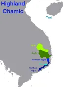
All four towns began as a highland village, a mission or a colonial post, and all four are now majority Vietnamese. Each was made a capital by someone else, for someone else’s purpose: to hold the Rhade, to watch the Jarai, to house a mission and a garrison, to give Europeans somewhere cool to be. In each of them we were sworn, or paraded, or promised something; in each we marched, and in each we were shot at. And in each the old village is still there, at the edge, as a ward with a Rhade or Bahnar or Jarai name, and its people go into the town to sell and to be counted. The names are the last thing in them that is still ours (see Names and words and A map of the highlands).

See also: The French arrive, 1876–1929, The Kon Tum mission, Sabatier and the Rhade code, The American years, 1975, A map of the highlands.
Sources
- P. Cupet, Mission Pavie: Géographie et voyages III (1900), pp. 340–346, 422, DCHO library — Kon Tum on February 21, 1891; P. X. Dourisboure, Dictionnaire bahnar-français (1889), pp. 216, 380, DCHO library — kon and tum
- Minority Groups in the Republic of Vietnam (1966), pp. 671–732, DCHO library — “the father of Thuot”; Gerald C. Hickey, Shattered World (Philadelphia, 1993), pp. 3–7, and RAND RM-5281 (1967), pp. 30–32, 54, 82, DCHO library — Ban Me Thuot as market town, the loincloth ban, the strike of September 9, 1958, the land-development centers
- Central Intelligence Agency, The Highlanders of South Vietnam: A Review of Political Developments and Forces (June 1, 1966), pp. 10–25, 60, 71–73, DCHO library — 1945, the Crown Domain, the oath of 1955, the Vietnamese population, the revolt of September 1964
- Mathieu Guérin, Des casques blancs sur le Plateau des Herbes (2003), pp. 118, 230–285, DCHO library — Ban Me Thuot 1899–1931, Kon Tum 1913, Pleiku 1905 and 1926, Dalat from Doumer to Decoux; Journal officiel, Chambre, March 18, 1927, DCHO library — Outrey’s description of Ban Me Thuot
- Bernard B. Fall, Street Without Joy (1961), ch. 9, “The End of a Task Force,” pp. 172–218 — Pleiku and Groupe Mobile 100, June–July 1954
- The Pentagon Papers, Gravel ed., vol. III, ch. 1 and chronology — Pleiku, February 7, 1965
- National Security Agency, The 1968 Tet Offensive (1970), DCHO library — Tet in the four towns; US Air Force, Project CHECO, Kontum: Battle for the Central Highlands, 30 March–10 June 1972 (1972), pp. 41–60, 68, on the Internet Archive — the refugees, the losses, the photographs on this page
- Cao Văn Viên, The Final Collapse (US Army Center of Military History, 1983), pp. 78–95, DCHO library; William E. Le Gro, Vietnam from Cease-Fire to Capitulation (1981), chs. 15–16, DCHO library — Ban Me Thuot, March 10, 1975, and Route 7B
- Human Rights Watch, Repression of Montagnards: Conflicts over Land and Religion in Vietnam’s Central Highlands (2002), chs. 3, 6 and 10, and “Violence against Montagnards During Easter Week Protests” (April 14, 2004) — 1958, the population figures, February 2001, April 2004
- Christopher Goscha, ed., Historical Dictionary of the Indochina War, “Pays Montagnards du Sud” and the entries on the Dalat conferences of 1946
- Eric T. Jennings, Imperial Heights: Dalat and the Making and Undoing of French Indochina (Berkeley, 2011), chs. 1–2 and 9–11, the last excerpted at viet-studies — Yersin’s journal, Dankia, the populations of 1958 and 1975, 1946–75
- IRFA, notices on Martial Jannin and Jean Sion; diocese of Kon Tum, “Giới thiệu sơ lược về Giáo phận Kon Tum” — the cathedral of 1913–18, the seminary, the vicariate
- Census of April 1, 2009, totals as given by citypopulation.de
- Our own records
Compiled September 2026. The meanings of the place names are as usually given, with the two we can document from a dictionary and a footnote marked as such; if your elders explain a name differently, please tell us.